- Author Harold Hamphrey hamphrey@travelwaiting.com.
- Public 2023-12-17 10:06.
- Last modified 2025-01-24 11:10.
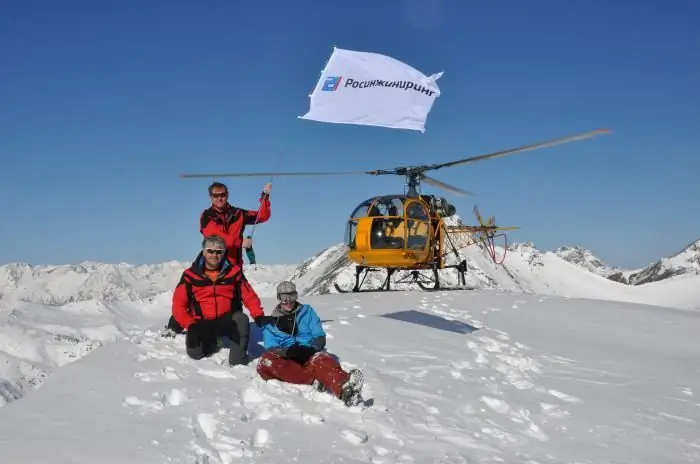
Do you know that in our homeland there are alpine meadows that are not inferior in beauty to the slopes of Tyrol or Cervinia? A continuous sea of flowers and fragrant herbs stretches at an altitude of about two thousand meters in the Western Caucasus, between the Krasnodar Territory and the Republic of Adygea. This is the Lagonaki plateau. Photos of this wonderful place are worthy of decorating wall calendars, travel magazine covers and computer screensavers. Well, how about relaxing on this high plateau? This place is for everyone who is attracted by an active lifestyle. Horseback riding, cross-country skiing, quad and mountain bike rallies, trekking, rock climbing, caving and whitewater rafting are all found here in abundance. Holidays in Lagonaki are not at all associated with Spartan living conditions. On a hill there are both ski resorts and camp sites.

Where is the Lagonaki Plateau
Administratively, the territory of this former pasture, and now -Caucasian Biosphere Reserve, almost all of it belongs to the Maykop region of Adygea. Only the northern part of the plateau (up to the Kurdzhips River) and the western slopes of Mount Messo are included in the Krasnodar Territory, Apsheronsky District. On all sides, alpine meadows are surrounded by mountain peaks. From the east, its borders are outlined by the Stone Sea ridge - a bizarre heap of rocks. Mount Messo rises to the west. All significant peaks surround the plateau from the south: Fisht (2854 m), Oshten (2804 m) and Pshekha-Su (2743.8 m). Their shining peaks in clear weather can be seen even from Krasnodar. The mountains can be perfectly observed from Sochi. But from Lagonaki, these peaks do not seem so out of reach. After all, the plateau itself lies at an altitude of 2200 meters above sea level.

How to get there
Bad, difficult and long road is the only minus of rest on the Lagonaki plateau. The map shows that numerous stone seas and deep sheer canyons with raging rivers make the path much more difficult. By train, you can only get to Belorechensk. Then you can take a bus going in the direction of Armavir and get off at the turn, where there will be a road sign for Lago-Naki. Well, and then - only rides, and the asph alt ends soon, and the road becomes difficult (especially in winter) due to the large slope. The area near the Big Azishskaya cave is especially dangerous. But there is also a more convenient road from Maikop. You need to pass Khadzhokh and the village of Dakhovskaya. Then the serpentine begins with excellent observation platforms along the roadsides. Entrance to the territory of the Caucasian Reserve is paid.
Whereaccommodate
A holiday on the Lagonaki plateau is a holiday with a capital letter. Among the flower-grass sea, surrounded by mountain peaks and glaciers, hotels of all levels rise - from modest shelters and tourist bases to comfortable hotel centers. The record holder for "stardom" is the Azish-Tau complex. Here you can hire a professional horseback riding or skiing instructor, a guide to the mountains, a senior in rafting on the Pshekhi and Belaya rivers. The spot-tourist hotel Zvezdnaya Dolina welcomes outdoor enthusiasts. There are especially many camp sites on the plateau. "Alpika", "Mountain Kuban", "Lago-Naki", "Tender Glade", "Fir Forest", "Edelweiss", "Silver Key" - some names sound like a song.

Climate
Despite the considerable height at which the Lagonaki plateau is located, the winters here are mild. Even in January there are long thaws, and the average January temperature is +4 degrees. This is due to the fact that warm winds from the Black Sea blow here in winter. But summer pleases tourists with light freshness. Plus, eighteen to twenty degrees under a cloudless sky is the best temperature to go on a mountain hike. Snow covers the alpine meadows from the end of November. And spring fully comes into its own from the second half of April. But the icy air masses that have stagnated near the mountain peaks can suddenly collapse on the Lagonaki plateau. The weather is very changeable in May and September. Even snowstorms are not uncommon during these months.

Tourism
Thrill-seekers are provided with a particularly wide range of entertainment. On ATVs, bicycles, on horseback, on foot - many routes run along the plateau. You can also soar in ascending air currents on a para- or hang glider. Speleotourism and rafting are no less developed here. There are about 125 caves on the Lagonaki plateau. The most beautiful of them are available for visiting. Majestic stone halls decorated with stalactites and stalagmites, underground waterfalls and lakes - all this can be seen in the caves "Nezhnaya" and "Bolshaya Azishskaya". Fans of mountain trekking are attracted by glaciers on the Pshekhasu and Fisht mountains. Rafting instructors and equipment can be ordered to safely raft down the Belaya River. Well, for those who love a relaxing holiday and unity with nature, light one-day hikes-walks along the slopes of the mountains are suitable. Here you can observe how the altitudinal zonality is changing: laurel cherries give way to rhododendrons, junipers and grassy meadows…


