- Author Harold Hamphrey [email protected].
- Public 2023-12-17 10:06.
- Last modified 2025-01-24 11:10.
In the northernmost part of the Ural Mountains is Mount Payer, which has become a gathering place for avid climbers. It has a harsh climate and often bad weather. However, this does not affect the decision of adventurers to admire the beauties of the northern massifs.
Polar Urals
It is located in the north of Eurasia on Russian territory. The area of the entire array is about 25,000 km2. It has a harsh continental climate. Due to its location, the Polar Urals is famous for its harsh snowy winters and strong winds.
These mountains mark between two parts of the world: Europe and Asia. There is also a junction between the Komi Republic and the Yamalo-Nenets Autonomous Okrug.

For the first time the traveler AI Shrenk thought about the name of the array. It was then that he proposed the "Polar Urals". The massif was thoroughly studied in the 19th century. In the north, the ridge is bounded by Mount Konstantinov stone. In the south - the upper reaches of the Khulga River.
One of the special features of Mount Payer is the height that attracts climbers. There are passes through the watershed. The transpolar railway passes through a similar area andarrives in Kharp and Labytnagi. The convenient location of the transport network attracts many tourists to these mountains. Climbing such massifs requires a lot of experience and skill.
In some places the mountains reach a width of 70-80 km. Because of this, pits and river valleys are formed. The "scattered" part of the Urals stretches for 170 km, after which the mountains close, and their width does not exceed 15-20 km. The narrower section is about 200 km long.
The age of the Polar Urals is 250-300 million years. In this area there is the deepest lake - Bolshoye Shchuchye (characteristic of this massif). Its depth is 136 m.

Peak peaks of the Polar Urals
If we consider the ridge from north to south, then the most significant heights are:
- Konstantin's stone. The mark of his "growth" stopped at 483 m.
- Ngetenape. After Konstantinov's stone there is a sharp jump to a mark of 1,338 km.
- Kharnaurdy-Keu. It is known that the Polar Urals is popular for its passes. This peak, reaching 1,246 km in height, forms just such a transition with the previous one.
- Hanmei. Its peak rises at an altitude of 1,370 km.
- Mount Payer - height is 1,499 km.
- Folk. The mark of "growth" of this peak is 1,895 km.
Mount Payer is the most popular. Its mark may be lower than the highest peaks in the world, but it is also fraught with danger. Climbers love the mountain because the path is difficult, but allows you to gain experience and dexterity, andalso enjoy the views.

Location
It's time to explore the most visited array. One of the highest peaks of the Polar Urals is Mount Payer. Where it is, you need to know. The mountain is located in the Yamal-Nenets Autonomous Okrug. Like other ridges and massifs, it can "boast" of height differences. In a particular case, it is about 600-750 m. Its basis is quartzites, shales and eruption products. In addition, there are "snowfields" on the mountain. These are understood as a motionless accumulation of frozen precipitation, protected from wind and sun.
Mount Payer is an array consisting of 3 highest peaks:
- Western. Its height is 1,330 km.
- Oriental. Its height is 1,217 km.
- Payer. Its top is flat due to a sharp rocky uplift. The height of the peak is 1,472 km.
Researcher Hoffman clarified that the name is translated from Nenets as "Lord of the Mountains". The grandeur and beauty of the area attracts hundreds of climbers. However, in bad weather, the mountain is shrouded in dense fog, which can cause travelers to get lost and suffer.

Payer climbing route
The most favorable time for climbing to heights in this area is summer. However, there are brave men who climb even in winter. Experienced climbers insist that it is absolutely impossible to do this: there is a high probability of an avalanche coming down.
At an altitude of about 700 m above sea level, a river can be seen. Often hereclimbers set up camp. The river is quite turbulent, which is proved by its noisy course. From here you can see the endless tundra and mountains.
If the ascent point is Mount Payer, the photo can be taken on the way. However, you need to stock up on warm clothes and a burner for cooking. Since the mountain is located outside the Arctic Circle, there are no forests as such.
Experienced climbers call Payer the "pearl" of the Polar Urals. This mountain is considered an ideal place to release energy and enjoy natural beauty from a bird's eye view.

Tourism in the Polar Urals
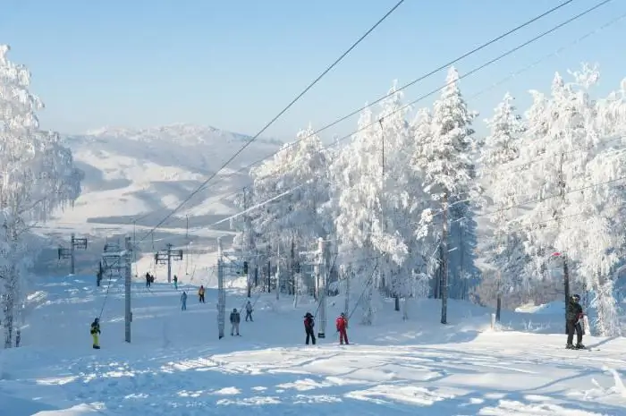
The southern part of the massif attracts a large number of travelers, as well as lovers of hiking, water, skiing and sports tourism. Extreme recreation is also held in high esteem here. The maximum distance is only 60 km. On the territory of the Polar Urals there are operating ski resorts. Water sports enthusiasts lay routes of varying difficulty along the rivers flowing here.
Among the main tourist areas, arrays stand out:
- Rise;
- Sobsky;
- G. Blucher;
- Payer;
- Karovy, etc.
As a rule, ski trips are organized in April - early May. For hikers, the most favorable time is considered to be July-mid-August, when the daytime temperature does not form sharp jumps and is stable.


